Subject: Rhode Island & Massachusetts
Period: 1939 (dated)
Publication:
Color: Printed Color
Size:
25.6 x 17.3 inches
65 x 43.9 cm
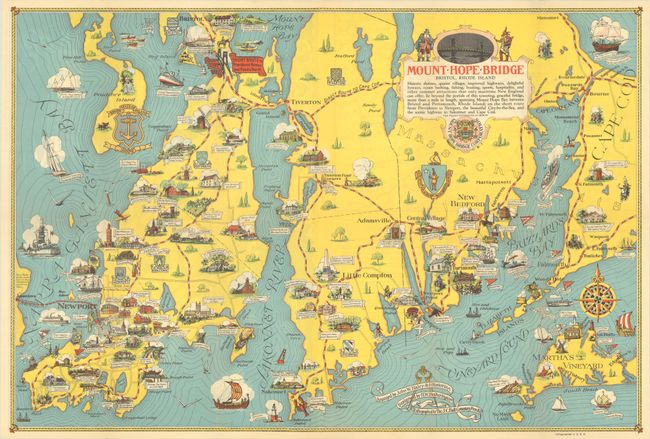
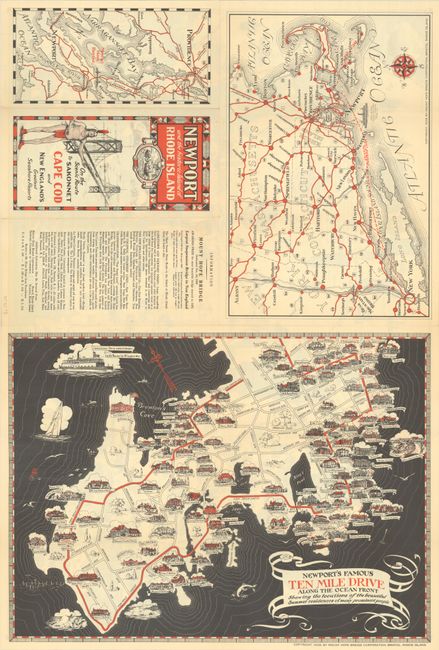
A charming pictorial map extending from Bristol and Newport east to Cape Cod and Martha's Vineyard showing "historic shrines, quaint villages, improved highways, delightful byways, ocean bathing, fishing, boating, sports, hospitality, and other summer attractions that only maritime New England can offer..." The text indicates that these activities are enabled by the recently opened one-mile Mount Hope Bridge, connecting Bristol to points east. Filled with illustrations on both land and water along with historical notes. Hornsby described this map as "one of the most attractive of the mass-produced tourist maps published before World War II." The verso contains a smaller pictorial map of Newport’s Famous Ten Mile Drive. Designed by H.W. Hetherington and lithographed by the J.C. Hall Company.
References: Hornsby (Picturing America) #82; Rumsey #8737.
Condition: A
A clean and colorful example with one tiny puncture hole (adjacent to Bournedale) that has been archivally repaired on verso. Issued folding.