Subject: Western North Carolina
Period: 1882 (published)
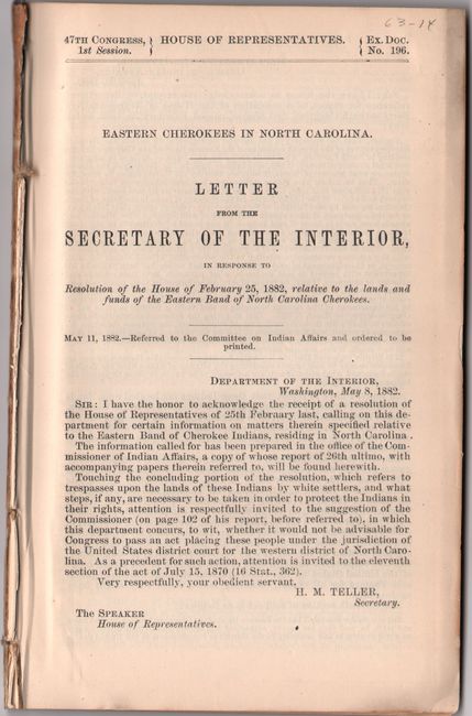
Publication: H.R. Doc. 196, 47th Congress, 1st Session
Color: Printed Color
Size:
5.8 x 9.1 inches
14.7 x 23.1 cm
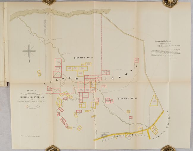
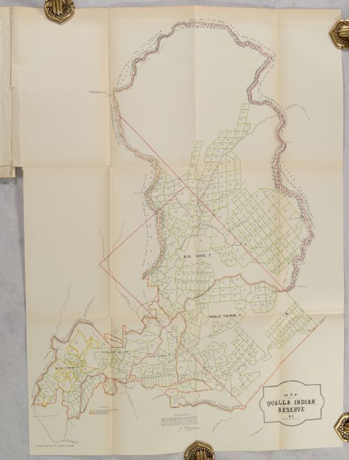
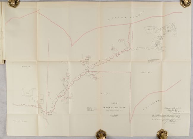
This uncommon report discusses in detail the land titles of the Eastern Cherokee Indians in western North Carolina. It notes that "the title to these lands had, for several years, been the subject of litigation growing out of the fact that the deeds for these lands, purchased with tribal funds at sundry times in 1861 and previously by the late United States Indian agent, William H. Thomas, had been taken in the name of the agent instead of in the name of the Indians." Due to the Civil War and Mr. Thomas "having become insane," it took Congress and the courts years to properly award title to these lands. The report features three folding maps illustrating these titles at the end of the report including:
Diagram Showing Lands Belonging to Cherokee Indians in Graham County, North Carolina (14.5 x 18.5"). Shows the Cherokee land surveyed under the contract of 1875 and 1878, colored in yellow and red respectively.
Map of the Qualla Indian Reserve N.C. (16.0 x 23.0"). This detailed map shows hundreds of individual plots occupied by the Big Cove, Wolf Town, Paint Town, Yellow Hill, and Bird Town Tribes. This reservation in western North Carolina is still in existence today and has a population of over 9,600.
Map of Districts Nos 1.5.6 &c 7. in Cherokee County, N.C. (26.5 x 18"). This map shows the region between Graham and Clay counties. Signed in the plate by J.A. Williamson, Commissioner.
68 pages. Disbound. The report is housed in archival paper covers with handwritten label.
References:
Condition: B+
The folding maps are very good with some light toning and minor offsetting. Disbound text is also lightly toned.