Subject: New York City, New York
Period: 1939 (dated)
Publication:
Color: Printed Color
Size:
27 x 26.1 inches
68.6 x 66.3 cm
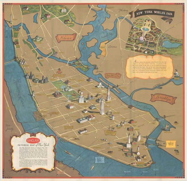
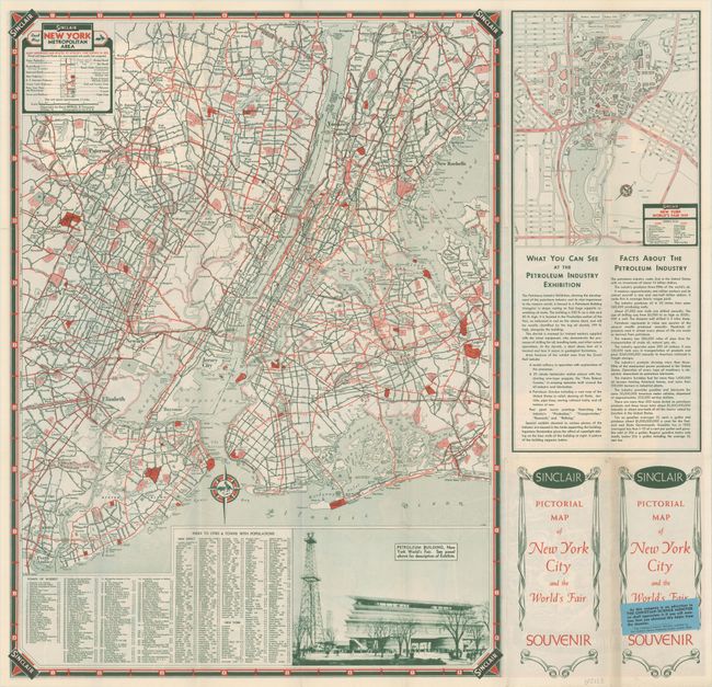
This pictorial souvenir map focuses on New York City and the site of the 1939 World's Fair. It was drawn by graphic artist George Annand and published by Sinclair Oil, likely with the hope of drumming up interest in the Petroleum Industry Exhibition at the fair. In addition to the fairgrounds, the map highlights numerous New York landmarks, including Central Park, the Chrysler Building, Grand Central Terminal, the Empire State Building, Madison Square Garden, Washington Square Park, and the Brooklyn Bridge. Harlem is represented by a dancing woman, and Greenwich Village by a painter at work. The verso includes maps of the New York metropolitan area and the World's Fair site and extensive information on the Petroleum Industry Exhibition.
References:
Condition: A
Clean and bright and issued folding. The front cover of the pamphlet has a hint of toning along the edge and a small label for the <i>Christian Science Monitor</i> affixed to it.