Subject: New Hampshire
Period: 1813 (dated)
Publication: Carey's General Atlas
Color: Hand Color
Size:
11.1 x 17.7 inches
28.2 x 45 cm
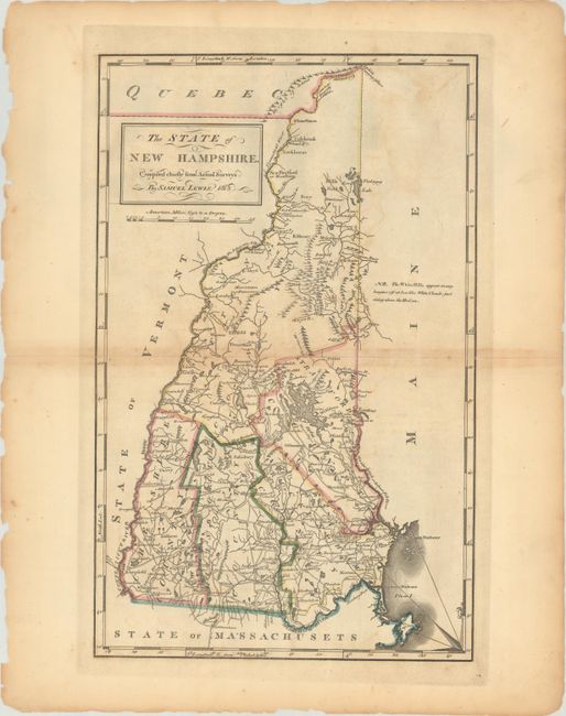
An attractive map of the state with five counties and great detail of the roads, settlements, mills and taverns. A note on the map states "The White Hills appear many leagues off at sea like white clouds just rising above the horizon." Two of the most influential names in American cartography were Samuel Lewis and Mathew Carey. Samuel Lewis was a celebrated draftsman and cartographer who learned his trade from the prominent English cartographer Aaron Arrowsmith. Carey was the first major American publisher of maps and atlases, and published the first American atlas in 1795. This map is from the important 1814 edition of the atlas.
References: Cobb (NH) #89; Phillips (A) #1372-7.
Condition: B
A strong impression with some toning along the centerfold, faint offsetting, and small chips and tears along the edges of the sheet. There are centerfold separations at right and left that have been archivally repaired.