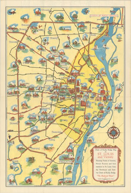
Subject: St. Louis, Missouri
Period: 1940 (circa)
Publication:
Color: Printed Color
Size:
11 x 16.5 inches
27.9 x 41.9 cm
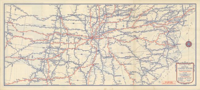
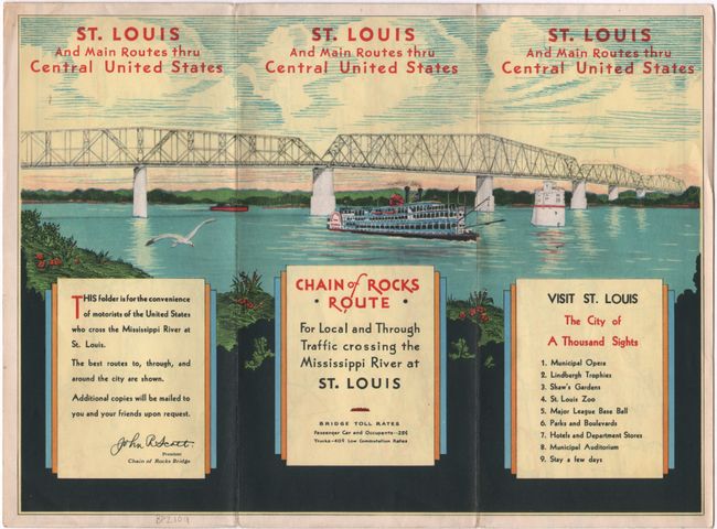
This charming pictorial map highlights the Chain of Rocks Bridge that spans the Mississippi River between Missouri and Illinois. The bridge opened in 1929 and closed to motor traffic in 1970. In addition to the bridge, the map depicts several sites of interest in St. Louis, including the St. Louis Art Museum, the Municipal Opera, the zoo, the Cathedral Basilica of Saint Louis, City Hall, the Anheuser Busch Brewery, several colleges, parks, and more. There is excellent detail of routes around the city. On verso is another map, Auto Road Map of Central United States Showing Motor Routes to Chain of Rocks Bridge, St. Louis (25.5 x 11.0"), which extends from Denver east to New York City and from Milwaukee south to Dallas-Fort Worth. Self-folds into a pamphlet with a three-panel illustrated cover showing the sweep of the bridge.
References: Rumsey #11288.
Condition: A
Issued folding with a hint of soiling along the edges of the pamphlet covers.