Subject: Massachusetts
Period: 1814 (circa)
Publication: Carey's General Atlas
Color: Hand Color
Size:
17.9 x 12.3 inches
45.5 x 31.2 cm
Mathew Carey was a seminal figure in early American publishing; establishing the first publishing firm to specialize in cartography and issuing the first atlas devoted exclusively to American maps. He set up an elaborate cottage system of craftsmen for compiling, engraving, printing, and coloring maps. This practice was emulated by later American cartographic publishers such as John Melish and Henry S. Tanner. The American Atlas concept was also adopted by other publishers in both the United States and Europe.
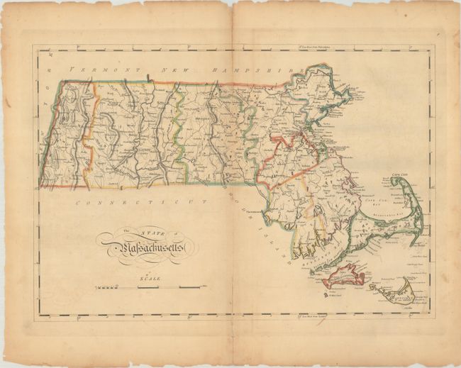
This early map of Massachusetts illustrates the hills, streams, ponds and lakes, county boundaries, main roads, and towns. It extends to include Martha's Vineyard and Nantucket. County configuration is current to 1810, prior to the creation of Franklin County from Hampshire (1811).
References: Phillips (Atlases) #1372-9.
Condition: B
There is light toning along the centerfold, faint offsetting, and small chips and tears along the edges of the sheet. Centerfold separations at top (1.25") and bottom (2") have been closed on verso with archival tape.