Subject: Florida
Period: 1885 (published)
Publication:
Color: Hand Color
Size:
7.7 x 15.5 inches
19.6 x 39.4 cm
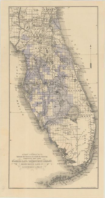
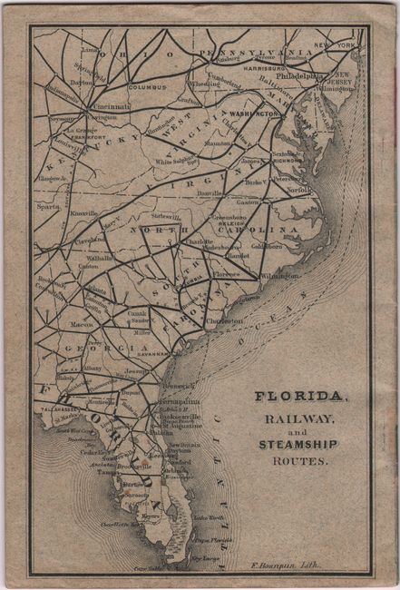
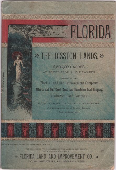
This fascinating map depicts 2,500,000 acres of land for purchase in Florida, owned by the Florida Land and Improvement, Okeechobee Land, and Kissimmee Land companies. The shaded areas were part of the Disston Land Purchase, the most land ever purchased by a single person in the history of the world. In 1881, the industrialist and developer Hamilton Disston (1844-96) purchased four million acres of public land and began to sell it on the cheap. (According to this promotional material, the going rate was $1.25 to $25 per acre.) Disston's investment lead to a boom in railroads and canals and the growth of St. Petersburg and the development of Kissimmee. The map is accompanied by a promotional booklet that includes information about the land for sale and black & white illustrations of the state's many attractions. A map on the back cover depicts railway and steamship routes from the Mid-Atlantic south to Florida. 40 pages. Soft illustrated covers. Lithography by F. Bourquin. Published by the Florida Land and Improvement Co.
References:
Condition: B+
The map is issued folding with faint, pleasant toning. Accompanying booklet is lightly toned with minor foxing and soiling on the wrappers.