Subject: Western United States
Period: 1878 (published)
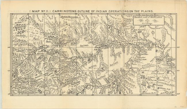
Publication: Ab-Sa-Ra-Ka Land of Massacre: Being the Experience of an Officer's Wife on the Plains...
Color: Black & White
Size:
11.2 x 5.6 inches
28.4 x 14.2 cm
This small but highly detailed map covers the area from Fort Stevenson (Dakota Territory) west to Helena and north to the Canadian border. It is densely filled with forts, Indian tribes, rivers, and elevation via hachure. It was one of two maps issued in Margaret Irvin Carrington's Ab-Sa-Ra-Ka Land of Massacre…, a narrative about her life as the wife of a military officer in Indian Country. Her husband, Colonel Henry Carrington, was appointed commander of the Mountain District, Department of the Missouri after a successful stint as an intelligence officer in the Civil War. He was tasked with protecting the Bozeman Trail for both emigrants and miners heading to the Montana gold regions. As part of his role, he supervised the construction of Fort Phil Kearny, which served as his (and his wife's) home base during Red Cloud's War. This armed conflict between the Lakota, Cheyenne, and Arapaho Indians and the United States was fought over control of the Powder River country in north-central Wyoming. The Indians won the war and effectively ended Carrrington's military career.
References: Howes #C-175, Sabin #11061.
Condition: B+
Issued folding with minor offsetting and a couple of small archival repairs along the right fold.