Subject: South Central United States, Texas, Indian Territory
Period: 1844 (dated)
Publication: Commerce of the Prairies
Color: Printed Color
Size:
15.6 x 12.8 inches
39.6 x 32.5 cm
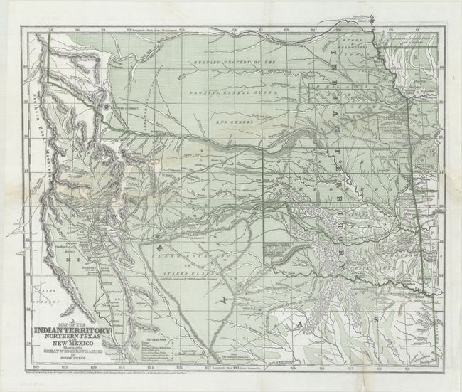
Wheat describes this as a "cartographic landmark" of the western territories and covers the area from Missouri, Kansas and Louisiana to the Rocky Mountains. It is the first edition, published just before the more common Morse and Breese atlas map, also dated 1844, but published in 1845. The map shows the northern part of the Republic of Texas reaching along the Rockies and has quite a bit of Indian Territory as well. New Mexico is shown, with Santa Fe as the destination of the route of the Santa Fe Caravans. The map has many tracks of explorers and other routes shown, with topography, towns, villages, smaller villages and ranches, Indian villages, forts, trading posts, ruins, springs, and camps. This would have been a very valuable map for anyone considering traveling across the prairie in the mid-19th century.
Josiah Gregg first went west in the 1830's to look for a cure for his tuberculosis. He recovered his health and traveled across the prairies as a merchant to Santa Fe, Texas and Mexico.
References: Wheat (TMW) #482; Wagner & Camp #108.1; Howes #G401.
Condition: B
Issued folding on a bright sheet with professional repairs to a long tear that extends across the entire upper-middle portion of the map as well as a few fold separations.