Subject: Quebec, Canada
Period: 1705 (dated)
Publication: Les Forces de l'Europe
Color: Hand Color
Size:
11.9 x 8.3 inches
30.2 x 21.1 cm
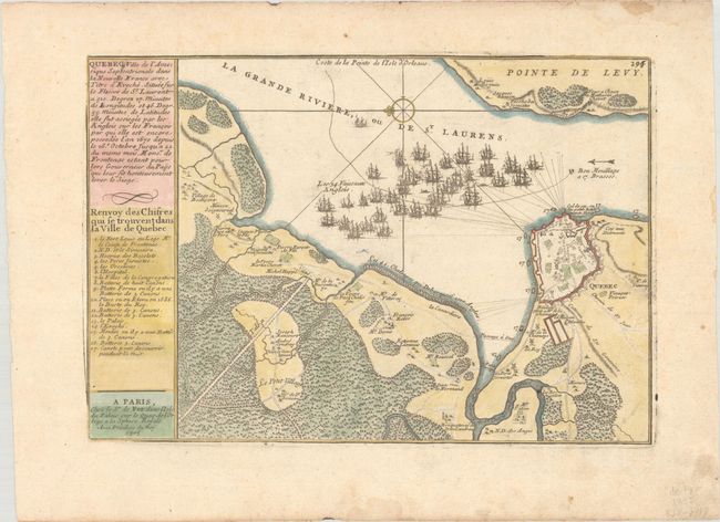
Nicolas de Fer held the title of geographer at Louis XIV's court. He was one of the most prolific publishers of plans of European cities in the late seventeenth century. The fortifications plans in Les Forces de l'Europe were designed to teach fortification techniques. Engraved by Van Loon and Schoonebeek after French engineers under the command of Vauban, the renowned military architect. The illustrations often include a description and a legend with the principal buildings; each city plan includes both fortifications and street layout.
This is the third state of De Fer's interesting map illustrating Sir William Phips' attack on Quebec in 1690. Phips, full of confidence from his recent military success at Port Royal, mustered a fleet from Boston for the expedition. The operation ended in disaster when the under-equipped force discovered the extensive defenses at Quebec. The map provides a great view of the battle lines of the fleet and details of the French defenses, based on manuscripts recorded by Villeneuve.
References: Kershaw #278.
Condition: A
On a sheet with a bunch of grapes crest and marginal soiling and damp staining.