Subject: North America
Period: 1809 (dated)
Publication:
Color: Black & White
Size:
15.8 x 9.9 inches
40.1 x 25.1 cm
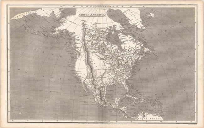
A finely engraved map of North America extending to include the Kamchatka Peninsula and the northern tip of South America. The eastern half of the continent is densely engraved along with central Canada, where McKenzie (1789) and Hearne (1771) had seen the sea. Issued prior to the Lewis & Clark discoveries, the map is mostly void of detail west of the Missouri River with dotted lines indicating possible river sources at the Rocky Mountains. At the farthest known point on the Missouri River "Villages of the Tall Indians and Manders" are noted, and the Stony Mountains stretch in nearly a straight line from the Arctic Circle to Mexico, continuing to Panama.
References:
Condition: B+
A dark impression with a few faint spots of foxing.