Subject: References, Virginia
Period: 1975 (published)
Publication:
Color: Black & White
Size:
14.5 x 11.5 inches
36.8 x 29.2 cm
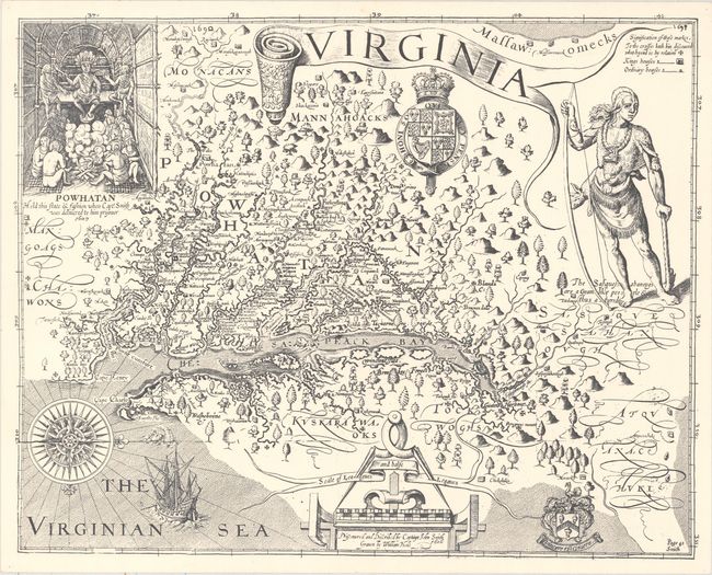
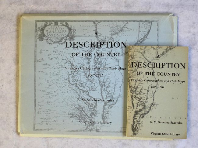
E.M. Sanchez-Saavedra wrote the accompanying text for this portfolio focusing on the cartographic history of Virginia. Published by the Virginia State Library, it includes facsimile reproductions of 9 maps on 20 sheets, 5 of which are in color. Among the maps are Captain John Smith's Virginia, the Fry-Jefferson map of 1775, and Captain Peter S. Michie's startlingly accurate manuscript survey of Richmond. According to the preface, "This portfolio is not intended to be a collection of cartographic museum pieces for decorative purposes; rather it attempts to show the evolutionary development of a vital branch of science." The maps are contained in a paper portfolio with an illustrated cover. The book (5.5 x 8.4") features in-depth essays on each map. Paperback, 130 pages.
References:
Condition: B+
Maps are in very good condition with minor extraneous creasing and a couple short edge tears. Portfolio has light shelf wear, and both portfolio and book covers are lightly sunned.