Subject: Geography Books
Period: 1762 (published)
Publication:
Color: Hand Color
Size:
4.1 x 6.8 inches
10.4 x 17.3 cm
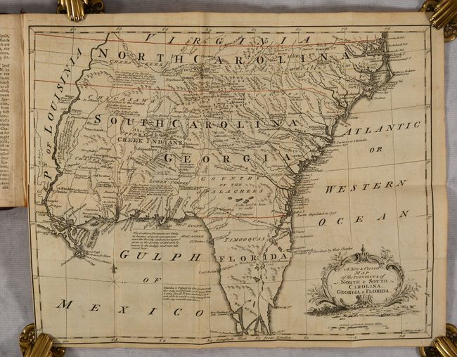
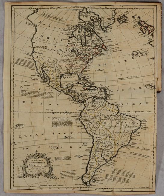
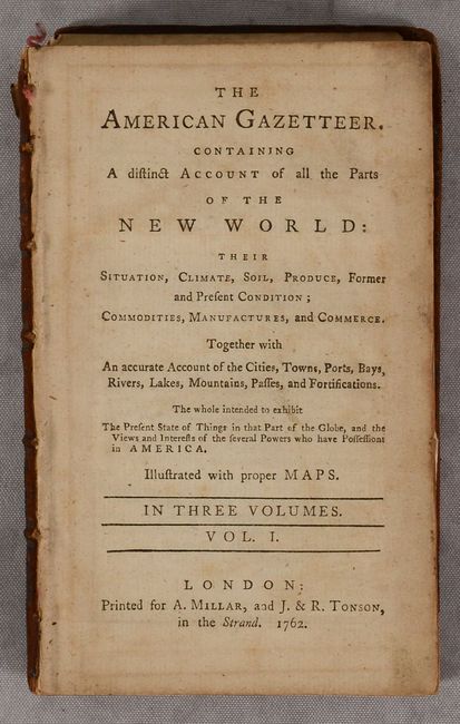
This is the first of the three volumes of Millar's The American Gazetteer. Containing a Distinct Account of All the Parts of the New World..., a rare French and Indian War-era gazetteer of the New World. Volume I spans in its alphabetical coverage from Abercorn (a Georgia village northwest of Savannah) to Fundy Bay. It includes two folding maps by the great engraver John Gibson: A New and Accurate Map of America, Drawn from the Most Approv'd Maps & Charts (11.0 x 13.9") and A New & Correct Map of the Provinces of North & South Carolina, Georgia, & Florida (13.9 x 11.0"). The first map, located at the front of the volume, depicts the Western Hemisphere. It is notable for its inclusion of the River of the West, which flows from an unnamed lake (perhaps Lake Winnipeg) to Cape Blanco. New Albion appears on the West Coast, with a nearby note on Sir Francis Drake's explorations in the region. The northwestern portion of the continent is labeled Parts Undiscovered. To the west of Louisiana is New Mexico in present-day Texas. For some reason, Fort Rosalie appears west of New Orleans. Virginia and the Carolinas extend west of the Mississippi. There are numerous notes throughout related to exploration and Indian tribes. The mythical Laguna de Xarayes is located in the middle of South America.
The second map covers the colonial Southeast from Florida north to Virginia's southern border. It features several towns, cities, and settlements, Indian tribes, rivers, topographical details, and roads. The landscape is covered in notes related to the Indigenous peoples, colonial possessions, and more. Examples include "The Indians on this River having formerly been in Alliance with the English, have been destroy'd by the French" (located along the Mississippi) and "The Southern Provinces are likely to become of great consequence since the Bounty and encouragmt. given by the Society of Art and Commerce to the Indigo and raw Silk raised here." English settlement extends west into Chickasaw territory. Florida is noted as a Spanish possession and disintegrates into an archipelago south of where Hernando de Soto landed in 1539. St. Augustine, "the only port Town," is located, and the "Bounds of Carolina by their Charter" is identified just south of Cape Canaveral. Another note in central Florida ominously states "Destroy'd by the Carolinians in 1706," referring to the English invasion of Spanish Florida.
Unpaginated. Printed for Millar and J. & R. Tonson in the Strand. Hardbound in full original leather.
References: Cumming (SE) #329.
Condition: B
The map of the Americas is in B condition with light toning and offsetting, a few short separations, and a 3" binding tear at right that has been closed on verso with archival tape. The map of the Southeast is in B+ condition with light offsetting and toning and a short binding tear at left. Text is lightly toned. The spine has perished, covers are detached, and the contents have been broken into 3 sections. Given the volume's scarcity, professional rebinding is recommended.