Subject: Western Hemisphere - America
Period: 1787 (dated)
Publication:
Color: Hand Color
Size:
24.6 x 18.4 inches
62.5 x 46.7 cm
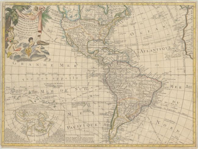
This uncommon map exhibits some speculative cartography on the Pacific coast of North America, including an appearance of the Sea of the West. A huge Mer ou Baye de l'Ouest dominates the northwest coast, but a tentative coastline also reflects the Russian discoveries in the region. The large inset map illustrates the theories of Joseph Delisle and Philippe Buache concerning the potential Northwest Passage and the Sea of the West. In the Pacific, the tracks of early explorers are shown, including Quiros, Mendana, Le Maire, Magellan, and Antoine.
References: McGuirk #123.
Condition: B+
A nice impression with minor toning, light soiling, narrow margins, and some tiny chips and tears along the edges of the sheet that have been archivally repaired. The map was previously mounted but has been professionally removed.