Subject: Western Hemisphere - America
Period: 1766 (circa)
Publication:
Color: Hand Color
Size:
12.4 x 11.1 inches
31.5 x 28.2 cm
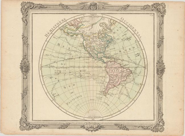
This attractive hemisphere map is surrounded in a decorative picture-frame style border that was printed from a separate copper plate. Cartographically, Brion has devised an ingenious way to show the competing theories of the Pacific Northwest. Philip Buache's concepts, including the mythical Mer de l' Ouest and B. de l' Ouest with its Northwest Passage, are engraved in faint hachure and colored in yellow. While the ideas of Gerhard Friedrich Muller, which includes the fabled River of the West (R. de l' Ouest) connecting through a network of lakes into both Lake Superior and Hudson Bay, are shown by a solid line. There is no sign of Antarctica and the coastline of New Zealand is indistinctly shown. The oceans are filled with the tracks of the major explorations. Brion was the former Geographer to the King of France, and Desnos was Geographer to the King of Denmark.
References: McGuirk #129.
Condition: B+
Contemporary color on watermarked paper with light foxing and a hint of toning along the centerfold. There are short centerfold separations at top and bottom and a few edge tears that cross into map border, all of which have been closed on verso with archival materials.