Subject: Japan & Korea
Period: 1749 (dated)
Publication: Atlas Portatif Universel et Militaire
Color: Hand Color
Size:
6.4 x 6.4 inches
16.3 x 16.3 cm
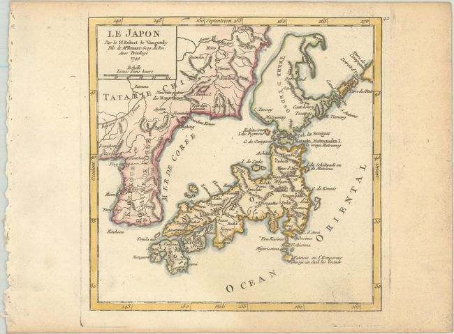
This little map of Japan and Korea draws mostly from the previous work of Bellin with the depiction of Hokkaido derived from De Vries. Hokkaido Terre d'Yedso appears as a large island separated from Chinese Tartary by a narrow strait. To the east is Terre de la Compagnie based on erroneous Dutch reports. The sea between Korea and Japan is named Mer de Coree. The Great Wall is delineated along the border between Korea and China. An island offshore and south from Jedo that was used as a prison is labeled Fatsisio ou l'Empereur envoye en exil les Grands. The map bears the names of both Didier and Giles, father and son.
References: Hubbard #100.2; Pedley #409; Walter #85A and OAG-99.
Condition: B+
Watermarked paper with minor soiling at bottom right and light toning along the edges of the sheet.