Subject: Holy Land
Period: 1652 (circa)
Publication:
Color: Black & White
Size:
21.3 x 16.5 inches
54.1 x 41.9 cm
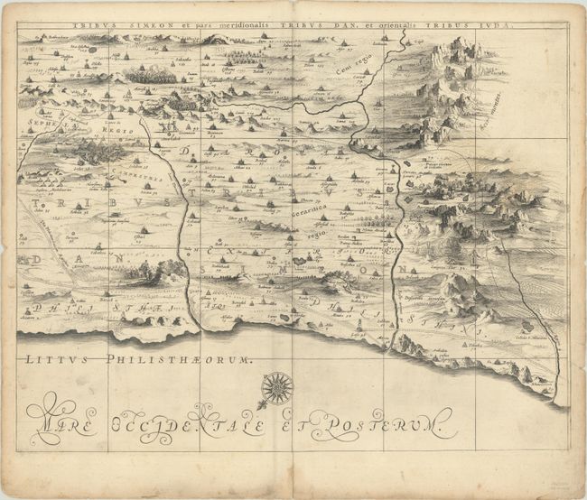
This is the bottom right sheet of Jansson's 6-sheet wall map based on Adrichom's "Situs Terrae Promissionis." Oriented to the east, the wall map shows the region divided into the twelve tribes on both sides of the Jordan River, the shoreline running from Sidon to Alexandria. This sheet shows the regions of the Tribes of Dan and Simeon, extending east to Mount Seir. The dramatic map is beautifully engraved to show topographical features, major roads, towns and villages and is richly embellished with dozens of biblical illustrations. Blank verso.
References: Laor #349; Van der Krogt (Vol. I) #8150:1D/6.
Condition: B+
A dark impression with light soiling, an archivally repaired centerfold separation at bottom, and dampstains along the edges of the sheet.