Subject: Messina, Sicily, Italy
Period: 1745 (circa)
Publication: The History of England
Color: Hand Color
Size:
18.6 x 14.1 inches
47.2 x 35.8 cm
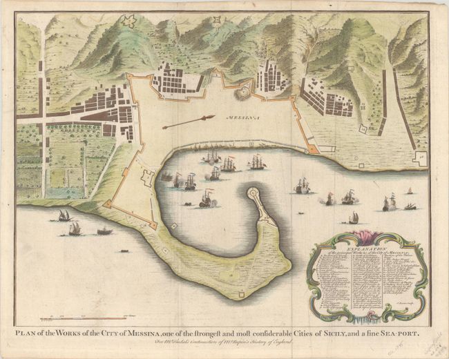
This map appeared in the fourth volume of Rapin de Thoyras' History of England, as continued by Nicholas Tindal. This bird's-eye plan depicts Messina during the War of the Quadruple Alliance, in which Spain was defeated by an alliance of Britain, France, Austria, and the Dutch Republic. After losing all of the Spanish possessions in Italy and the Low Countries in the Treaty of Utrecht at the end of the War of the Spanish Succession, King Philip V of Spain set out to retake territories in Italy and to claim the French throne. In July 1718 the Spanish invaded Sicily, first taking Palermo on July 7 and then sending half their troops along the coast to attack Messina. The Spanish succeeded in capturing Messina, but soon thereafter were defeated by an Austrian offensive. This plan depicts the Spanish and Austrians engaged in battle, with a decorative arrow orienting north to the right. A rococo-style cartouche contains a key identifying numerous locations on the map. Engraved by James Basire.
References: Shirley (BL Atlases) G.RAP-1a, #44.
Condition: B+
Issued folding on paper with a fleur-de-lis watermark and light soiling.