Subject: Romania & Bulgaria
Period: 1652 (circa)
Publication:
Color: Hand Color
Size:
18.7 x 14.1 inches
47.5 x 35.8 cm
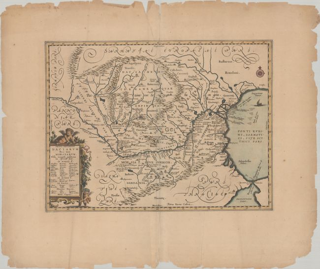
Impressive map of the area of Romania and Bulgaria that is centered on the Danube River. The map is based on Ortelius' map of the region, which was in turn based on classical sources. It was beautifully engraved by Petrus Kaerius to highlight the major cities, mountains and rivers and is embellished by a garland-draped title cartouche with two putti, a compass rose, and an oared ship in the Black Sea. Blank verso, possibly published in Georgius Hornius' Accuratissima Orbis Antiqui Delineatio (1652-84). This is the second state with the addition of a compass rose at top right.
References: Van der Krogt (Vol. I) #7710H:1.
Condition: B+
Wide margins with light toning and numerous chips and tears along the edges of the sheet, far from map image. There is minor creasing along the centerfold.