Catalog Archive
Auction 190, Lot 428

"Nouvelle Carte du Royaume d'Espagne, Dressee sur les Observations de Messieurs de l'Academie Royale des Sciences", Leth, Hendrik de

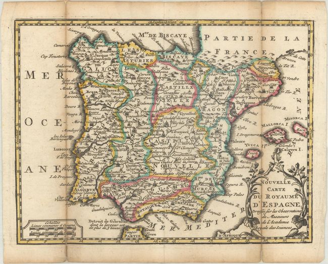
Subject: Spain & Portugal

Period: 1740 (circa)

Publication: Nouvel Atlas Geographique & Historique...

Color: Hand Color

Size:
8.5 x 6.5 inches
21.6 x 16.5 cm
Download High Resolution Image
(or just click on image to launch the Zoom viewer)

This small map of the Iberian Peninsula is filled with an amazing amount of detail for its size. A charming cartouche composed of tree branches surrounds the title. For his Nouvel Atlas, Leth made close copies of Jacques Chiquet's maps published in Le Nouveau et Curieux Atlas in 1719.

References: Shirley (BL Atlases) T.LETH-1a.

Condition: B+

A dark impression with contemporary outline color, issued folding with light toning along the folds and short fold separations that have been archivally repaired on verso.

Estimate: $100 - $130

Sold for: $75

Closed on 11/16/2022

Archived