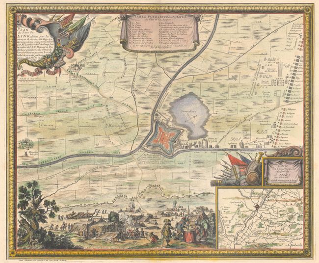
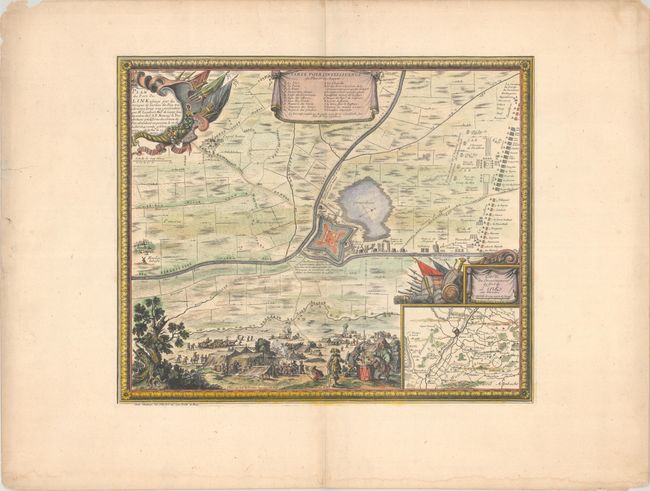
Subject: Northern France
Period: 1694 (circa)
Publication: Les Glorieuses Conquestes de Louis le Grand
Color: Hand Color
Size:
21.2 x 17.6 inches
53.8 x 44.7 cm
This delicately engraved map is centered on the fortified city of Linck, which is keyed to a table at top listing important buildings. The title cartouche indicates the city was besieged by the King's army on July 20, 1645 and the army's substantial position is depicted to the northeast of the city. An inset map at lower right depicts the Linck's government footprint to include Watten, Millam, and Merckeghem. A detailed scene of the army's camp is illustrated at bottom. Enclosed in a decorative frame border.
References: Pastoureau, BEAULIEU XV, I [51].
Condition: A
A nice impression on watermarked paper with wide margins. There are faint dampstains along the bottom sheet edge and a short repaired tear along the left sheet edge, both far from map image.