Catalog Archive
Auction 190, Lot 412

"Nouvelle Carte de la France Indiquant les Routes, les Chins. de Fer les Stations Thermales et Balneaires d'Apres les Documents les Plus Recents",
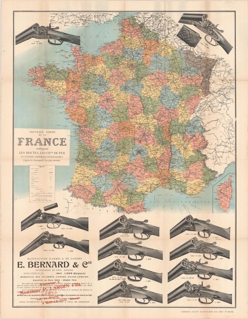
Subject: France

Period: 1900 (circa)

Publication:

Color: Printed Color

Size:
24 x 31.8 inches
61 x 80.8 cm
Download High Resolution Image
(or just click on image to launch the Zoom viewer)

This unusual promotional piece features a map of France surrounded by large illustrations of double-barrel shotguns produced by Emile and Cie Bernard of Liege, Belgium. The detailed map is delineated by department and presents the road network, canals, railroads, resorts, and more with a legend beneath the title. The company exhibited at the Exposition Universelle in 1900 and apparently produced this advertising piece for patrons. Red overprinting directs interested buyers to contact Monsieur P. Lardin in Meuse, France.

References:

Condition: B+

Issued folding with a few short splits at the fold junctions and some minor foxing in the margins. There are punch holes in the left blank margin.

Estimate: $275 - $350

Sold for: $150

Closed on 11/16/2022

Archived