Catalog Archive
Auction 190, Lot 404

Full Contemporary Color with Gilt Highlights

"[Lot of 2] Superioris Alsatiae nec non Brisigaviae et Suntgaviae Geographica Tabula... [and] Landgraviatus Alsatiae Inferioris Novissima Tabula...", Visscher, Nicolas

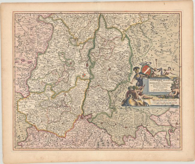
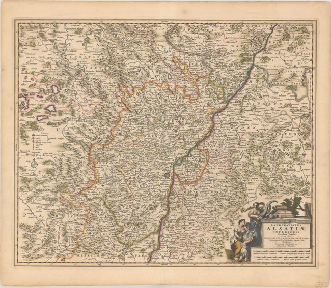
Subject: Western Europe, Rhine River

Period: 1680 (circa)

Publication:

Color: Hand Color

Size:
22.3 x 18.3 inches
56.6 x 46.5 cm
Download High Resolution Image
(or just click on image to launch the Zoom viewer)

This handsome pair of maps covers the Alsace region and the Rhine River valley from Speyer to Basel, showing parts of France, Switzerland and Germany. The map also includes the fortified cities of Strasburg, Colmar, Freiburg, Breisach and Schaffhausen. Each sheet stands on its own with full borders and a superb title cartouche. The cartouche on the northern sheet features a woman pouring food out of a cornucopia, and the southern sheet features a soldier, river gods, putti, and a vineyard.

References:

Condition: A

Sharp impressions with full contemporary color with gilt highlights, short centerfold separations at bottom that have been archivally repaired, and marginal toning.

Estimate: $350 - $425

Unsold

Closed on 11/16/2022

Archived