Subject: World
Period: 1598 (circa)
Publication: Geografia Cioe Descrittione Universale della Terra...
Color: Hand Color
Size:
6.9 x 5 inches
17.5 x 12.7 cm
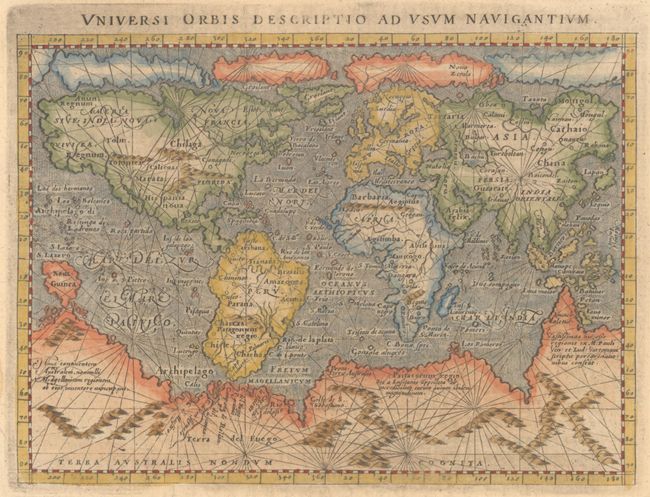
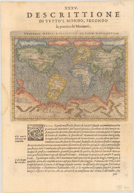
This small mariner's map is based on one of the most important world maps of the 16th century: Gerard Mercator's multi-sheet map of 1569. The map reflects the belief in wide Arctic sea passages and depicts a huge southern continent, to which Magini has added fanciful ranges of mountains. A fine network of rhumb lines crisscross the map, and the oceans are stipple engraved in the Italian style. Printed on a full sheet of Italian text (7.8 x 11.2"), with the text below the map providing navigational instructions. The map, engraved by Girolamo Porro, is from a Venetian edition of the quarto edition of Ptolemy's Geography that was edited by the distinguished Italian geographer Giovanni Magini. This example comes from an edition published in either 1598 or 1621.
References: Mickwitz & Miekkavaara #226-64; Shirley #196.
Condition: A
A nice impression with a dampstain in the left blank margin.