Subject: Low Countries
Period: 1640 (circa)
Publication:
Color: Hand Color
Size:
21.6 x 17.6 inches
54.9 x 44.7 cm
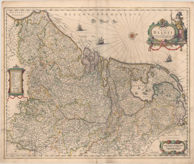
This handsome map of the Low countries extends south to Amiens, France and east to Cologne, Germany. The map is densely engraved with towns, political boundaries, rivers, topography, and other details. A compass rose orients north to the right. The map is further adorned with three galleons and three decorative cartouches, with Athena flanking the title cartouche. This is the first state prior to the addition of the date "1661" in the title cartouche. German text on verso.
References: Van der Krogt (Vol. I) #3000:1D.1.
Condition: B+
Full contemporary color with light soiling, some extraneous creasing along the centerfold, and an archivally repaired centerfold separation at bottom.