Catalog Archive
Auction 190, Lot 398

"Descriptio Germaniae Inferioris", Hogenberg, Frans

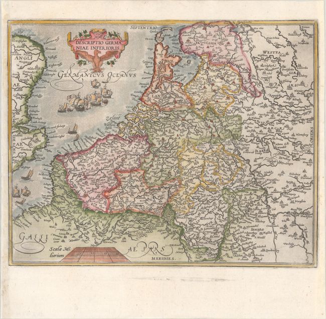
Subject: Low Countries

Period: 1599 (published)

Publication: Historia Belgica Nostri Potissimum Temporis Belgii sub Quatuor

Color: Hand Color

Size:
11.7 x 9.4 inches
29.7 x 23.9 cm
Download High Resolution Image
(or just click on image to launch the Zoom viewer)

This is Frans Hogenberg's uncommon map of the Low Countries, engraved circa 1587 and published in Emmanuel van Meteren's Historia Belgica. The map focuses on towns, political boundaries, and river systems and extends across the North Sea (Germanicus Oceanus) to show eastern England. Adorned with a decorative cartouche and a number of ships, some of which are engaged in battle.

References:

Condition: A

A crisp impression on a bright sheet with a single crescent moon watermark. The right and left margins have been professionally extended, and a tiny chip in the border at left has been repaired with a minor amount of the neatline in facsimile.

Estimate: $350 - $425

Sold for: $250

Closed on 11/16/2022

Archived