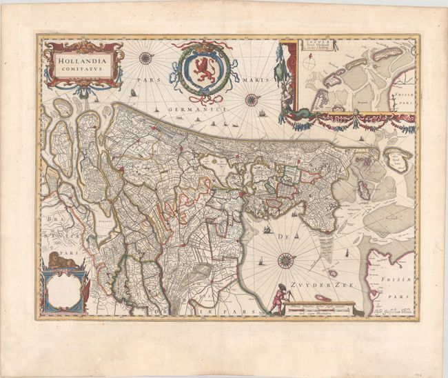
Subject: Western Netherlands
Period: 1643 (circa)
Publication: Theatre du Monde ou Nouvel Atlas
Color: Hand Color
Size:
20.7 x 15.5 inches
52.6 x 39.4 cm
This elegantly engraved chart is oriented with north to the upper right by three small compass roses. It shows the western half of the country including the present-day provinces of North and South Holland, Utrecht, and part of Zeeland and Brabant. Opposite of the Zuyder Zee (now IJsselmeer) is part of the province of Friesland. An inset shows the Wadden Sea and the islands off the northern coast. The map is embellished with tiny sailing ships and fishing boats as well as a coat of arms. There are three cartouches: one for the title at top left, a blank one with a lion seated on top of it (bottom left), and one encasing the distance scale (bottom right). French text on verso, published between 1643-50.
References: Van der Krogt (Vol. II) #3400:2B.
Condition: A
A crisp impression with full contemporary color, a few minor spots, and a minute wormhole in the map image. There are professional repairs confined to the bottom blank margin.