Subject: Central England
Period: 1713 (circa)
Publication: England Fully Described in a Compleat Sett of Mapps
Color: Hand Color
Size:
19.8 x 14.9 inches
50.3 x 37.8 cm
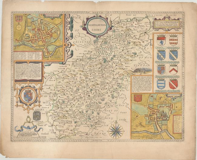
This classic decorative county map of Northamptonshire is from John Speed’s important English atlas. It divides the county into its hundreds and shows towns and cities, parks, hills, rivers, and more. Besides presenting the most up-to-date information in his maps, Speed also included detailed city plans; here there are plans of Northampton (at top left) and Peterborough (at bottom right), complete with coats of arms, distance scales, and keys indicating places of interest. Another inset pictures "the armes of all those honorable Families that have bene created Earles of Northapto, since ye Normans conquest." A vignette of the Battle of Edgcote, a battle fought in July 1469 during the Wars of the Roses, appears with a note describing the fighting. The map also includes a title cartouche, the royal coat of arms of the United Kingdom, a distance scale cartouche decorated with large compass calipers, and a large compass rose capped with a fleur-de-lis. Engraved by Jodocus Hondius. Published by Henry Overton, with strike-through of Basset & Chiswell's imprint. Blank verso.
References: Shirley (BL Atlases) T.SPE-1l.
Condition: B+
Minor toning on a sheet with a Strasbourg Bend & Lily watermark and soiling that is mostly confined to the blank margins. There is some minor extraneous creasing and a few small chips along the edges of the sheet.