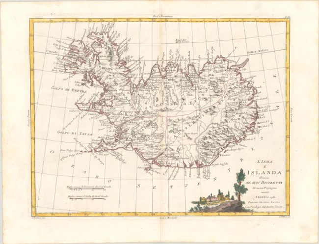
Subject: Iceland
Period: 1781 (dated)
Publication: Atlante Novissimo
Color: Hand Color
Size:
16.1 x 12.3 inches
40.9 x 31.2 cm
In 1752 the Danish scholar Niels Horrebow published an important book and map about Iceland. Based on the previously unpublished Knoff survey, his map was a major departure from previous maps drawing from Bishop Gudbrandur Thorlaksson's map of more than 150 years earlier. Thus, it marked a turning point in the cartography of Iceland. This is an Italian version of this historic map. It locates villages and churches and graphically delineates the mountains, rivers, lakes, and forests. The title cartouche features a view of a village. Engraved by G. Zuliani, with lettering by G. Pitteri.
References: Shirley (BL Atlases) T.ZAT-1a, Vol. 2 #28.
Condition: A
A sharp impression with the watermark of three crescent moons. There is minor toning along the centerfold.