Subject: Western Atlantic Ocean
Period: 1659 (circa)
Publication: De Zee-Atlas ofte Water-Waerelt
Color: Hand Color
Size:
21.4 x 17.2 inches
54.4 x 43.7 cm
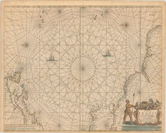
This is the first edition of this uncommon sea chart. It shows the area from Newfoundland to the northern coast of South America and across to the Azores and the Cape Verde islands in an unusual configuration derived from the Theunisz Jacobs chart of 1650, with north oriented to the left. Long Island is named as Gebroken lant, and New England is named as Nieu Nederlant, with no mention of the English colonial presence. The cartouche is surrounded by exotic denizens of the Americas, including a nearly nude native, armadillo, a turtle, a monkey and a parrot.
References: Burden #338.
Condition: B+
A crisp impression on heavy paper with light toning, tiny centerfold separations at top and bottom, and a narrow bottom margin, as issued.