Subject: Bermuda
Period: 1638 (circa)
Publication: Newer Atlas...
Color: Hand Color
Size:
20.4 x 15.5 inches
51.8 x 39.4 cm
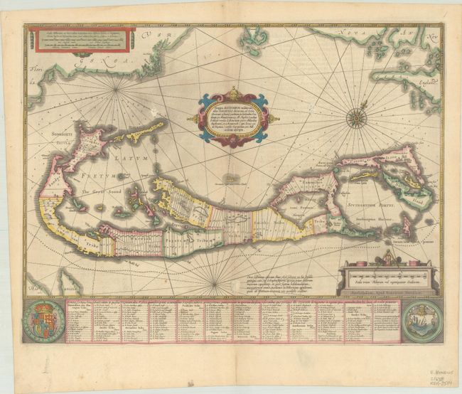
A striking map based on the famous survey by Richard Norwood of the Bermuda Company, also known as the Somers Isles Company, in 1618. The map shows the division into the original Tribes, which were a short-lived name for what became administrative parishes, and were names of major shareholders in the company. Also shown are the various landowners, with their names in a table below the map. There are many tiny houses shown on the map, locating settlements, as well as minute cannons marking the defensible points. The map is superimposed over a chart of the Atlantic with the coastlines of Britain, North America and Hispaniola showing the location of Bermuda. Decorated with an exquisite strapwork cartouche, a coat of arms, a medallion and a compass rose. German text on verso, published between 1638-42.
References: Palmer (MCC-19) #11; Van der Krogt (Vol. I) #9660:1.1.
Condition: B+
Contemporary outline color on watermarked paper with a pair of abrasions adjacent to the title cartouche and one along the lower centerfold. There are a few spots of foxing and light printer's ink residue.