Subject: North Pole
Period: 1659 (published)
Publication: Nuevo Atlas
Color: Hand Color
Size:
20.9 x 16.2 inches
53.1 x 41.1 cm
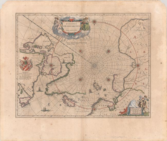
This important prototype map of the Arctic incorporates new information from the explorations of Capt. Thomas James with the bay named for him labeled here James his Bay. The Arctic coast of Russia provides information from Willem Barentsz' voyage and Spitsbergen is shown according the Danish expedition of James Hall. Rhumb lines radiate from the North Pole and a large title cartouche, with two figures and numerous wind heads, conveniently hides the northwest coast of America. The map is further decorated with several compass roses, ships and an additional cartouche that features men in parkas, a polar bear and foxes. Dedication to Guilielmo Backer de Corneliis (with Johanes Blaeu's imprint), indicates this issue is from the second state of the plate. Spanish text on verso. This is the first map in the first volume of Joan Blaeu's Spanish edition Atlas Maior.
References: Burden #252; Goss (Blaeu) #2; Van der Krogt (Vol. II) #0020:2.2.
Condition: B
Contemporary color on watermarked paper with some toning in the image and minor foxing. There are chips in the top corners of teh sheet and numerous tiny edge tears confined to the bottom blank margin that have been closed on verso with old tape.