Subject: Venezuela
Period: 1639-44 (circa)
Publication:
Color: Hand Color
Size:
19.4 x 14.8 inches
49.3 x 37.6 cm
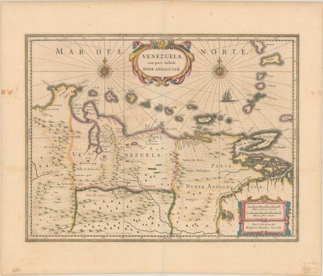
This beautifully engraved map is based on the cartography of Hessel Gerritsz. It covers the northern coast of South America, Venezuela, east to the mouth of the Orinoco, and includes the offshore islands from Aruba through Dominica and Tobago. The fine engraving illustrates the mountains, forests, rivers and missions in the interior, but shows place names primarily along the coastlines owing to the relatively few explorations made into the interior. The map is richly embellished with title and distance scale cartouches, compass roses and a galleon. Engraved by Evert Symonsz Hamersveldt and S. Rogeri. French text on verso, published between 1639-49.
References: Van der Krogt (Vol. I) #9830:1.1.
Condition: B+
A crisp impression with full contemporary color and light toning, soiling and offsetting. There is a short tear perpendicular to the centerfold near the bottom of the image that has been closed with archival tape on verso.