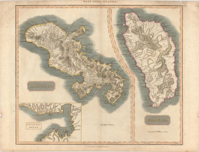
Subject: Martinique & Dominica
Period: 1814 (circa)
Publication: New General Atlas
Color: Hand Color
Size:
23.3 x 19.5 inches
59.2 x 49.5 cm
This sheet includes two copper engraved maps with common borders detailing the islands of Martinique and Dominica. The map of Martinique includes a large inset titled Cul de Sac Royal that shows towns, buildings, and the hospital. Both maps show good detail of topography, watershed, towns, and shipping channels. Thomson's publishing business prospered between 1813 and 1869. His maps are noted for their accuracy, strong impression, and fine engraving. Engraved by Kirkwood & Son.
References:
Condition: B+
Full contemporary color on a lightly toned sheet with short centerfold separations at top and bottom and light soiling that is largely confined to the blank margins.