Subject: St. Kitts
Period: 1650 (circa)
Publication: Cartes Generales de Toutes les Parties du Monde…
Color: Hand Color
Size:
16.8 x 12.3 inches
42.7 x 31.2 cm
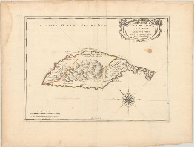
The elegant map is the earliest printed map of St. Kitts. The island is divided into three parts with both extremities marked French and the central mountainous region demarked as English. The settlements and forts are clearly shown as well as the favorable anchorages and dangerous parts of the coastline. The island was first colonized in 1623 by the British and the French in 1627. The Anglo-French rivalry lasted for more than 100 years and both powers used the island as a base of operations in the Lesser Antilles. The map is beautifully embellished with a lovely compass rose and title cartouche. Engraved by A. Peyrounin.
References: Tooley (MCC-81) St. Kitts #1.
Condition: B
A sharp impression with contemporary outline color on a bright sheet with bunch of grapes watermark, extraneous creasing along the centerfold, a stain below the title cartouche, a few small spots of foxing, and dampstains confined to the edges of the sheet.