Subject: World, World War II
Period: 1942 (circa)
Publication:
Color: Printed Color
Size:
21.3 x 16.6 inches
54.1 x 42.2 cm
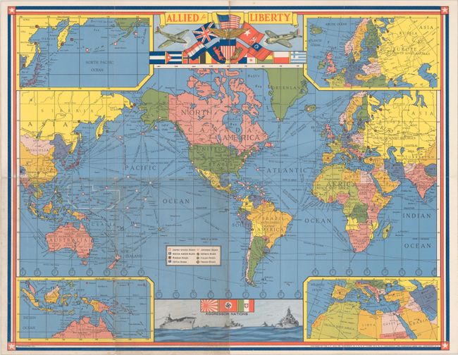
This World War II-era map was published after the United States entered the war and locates the military bases of the major combatants all over the world. The title cartouche shows fighter planes and the flags of the Allies, with the United States at the center. A vignette at bottom includes illustrations of warships and the flags of the "aggressor nations": Japan, Nazi Germany, and Italy. Insets in the four corners zero in on the North Pacific (top left), part of Europe (top right), Indonesia and northern Australia (bottom left), and the Mediterranean and its surroundings (bottom right). Time zones and distances between major ports are indicated throughout. Created by the J.C. Hall Co. in Pawtucket, Rhode Island, for Hassenfeld Bros. Inc., known today as Hasbro.
References:
Condition: B+
Issued folding with light soiling, a couple tiny splits at fold intersections, and minor wear along the folds.