Subject: Texas
Period: 1863 (circa)
Publication:
Color: Hand Color
Size:
24.6 x 16.9 inches
62.5 x 42.9 cm
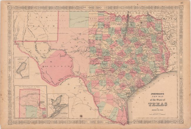
Large, handsome map with county development mostly in eastern Texas and only the three large counties of El Paso, Presidio, and Bexar in the west. The panhandle, noted as the Staked Plain (Elevated Table Land, without Wood or Water), includes a large section that is unorganized. Includes nice depictions of the wagon roads, many named, with several completed railroads. Insets include a Plan of Sabine Lake, Plan of the Northern part of Texas, and Plan of Galveston Bay. Surrounded by a decorative latticework border. Text on verso describes North America.
References:
Condition: B
There is light toning, minor foxing, and an extraneous crease at lower left. There is a small hole in the decorative border at top, and an edge tear that enters the bottom border that has been closed on verso with archival tape.