Subject: Texas
Period: 1845-50 (circa)
Publication:
Color: Hand Color
Size:
12.6 x 15.8 inches
32 x 40.1 cm
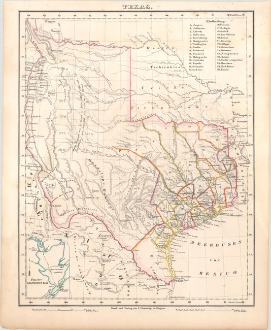
A. Texas, circa 1845. This German map is a reduced version of Arrowsmith's 1841 Republic of Texas map showing the full extent of Texas's claims to the region of the upper Rio Grande, including Santa Fe, Taos and Albuquerque. The detailed map shows many roads, rivers, towns, and forts. Thirty land districts are outlined and named in a table at the top right corner. The northern panhandle is divided into 12 sections, with the notation (copied from Arrowsmith) that the land was well wooded and watered. Includes a small inset of Galveston Bay at bottom left. Condition: There are some light dampstains along the sheet edges and minor mildew stains at top.
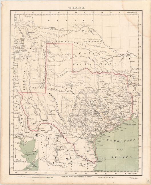
B. Texas, circa 1850. This is a later edition of the map showing Texas as a state with present-day boundaries. County development is confined to east Texas where there is considerable detail. Like the above map, the area around the northern panhandle is divided into 12 sections and there is a small inset of Galveston Bay. Condition: There is a dampstain in the top right corner of the sheet.
References:
Condition: B
Contemporary color. See description above.