Subject: Rhode Island
Period: 1796 (dated)
Publication:
Color: Black & White
Size:
12.9 x 17 inches
32.8 x 43.2 cm
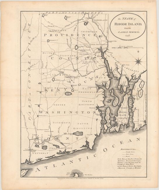
One of the earliest American-published maps of Rhode Island. It was engraved by Benjamin Tanner for John Reid's rare American Atlas, which was also the atlas to accompany Winterbotham's An Historical, Geographical, Commercial, and Philosophical View of the United States of America. The map depicts county boundaries, townships, topography, churches, mills, shipyards, roads, and bridges. It also shows several swamps and a Quicksand Pond, which on this map is located entirely in Massachusetts, whereas earlier maps showed it in Rhode Island.
References: Phillips (Atlases) #1216-8; Wheat & Brun #254.
Condition: B+
There is minor foxing and some faint offsetting.