Subject: Pennsylvania
Period: 1942 (circa)
Publication:
Color: Printed Color
Size:
22.1 x 16.4 inches
56.1 x 41.7 cm
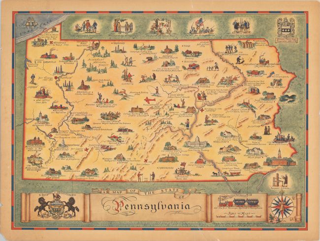
This historical map of the state was designed by Lawton Patten and published by the Historical Map Bureau in West Willington, Connecticut. It is filled with numerous illustrations showing historical events with notations, points of interest, and natural features including Washington's Crossing in 1776, Independence Hall, and the 1796 Muddy Creek Massacre. An attractive banner-style title cartouche at bottom includes the state seal, an illustration of the first passenger train in the state, and an elaborate 16-point compass rose with fleur-de-lis.
References: Rumsey #8922.
Condition: B+
There are a number of small edge tears, a few of which just enter the map border, that have been closed on verso with archival tape. Light toning.