Subject: Oklahoma
Period: 1901 (dated)
Publication:
Color: Printed Color
Size:
5.8 x 9.1 inches
14.7 x 23.1 cm
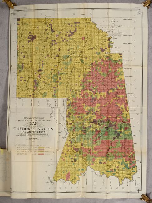
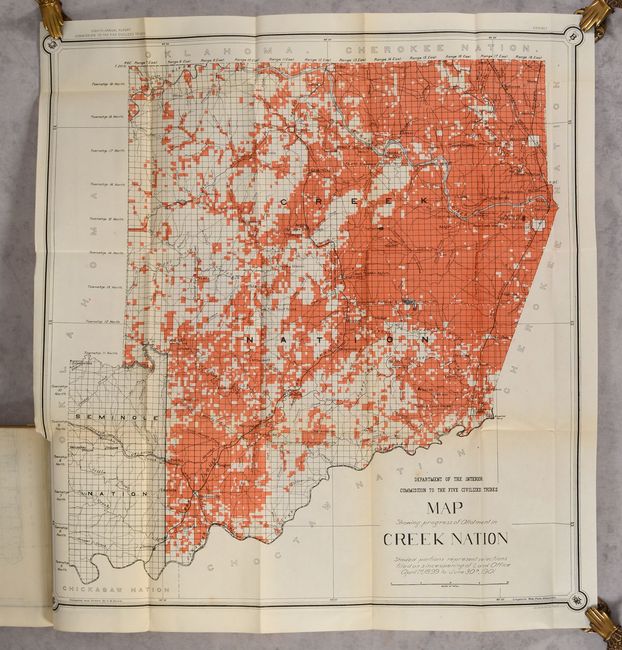
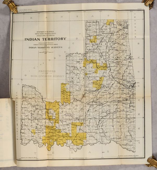
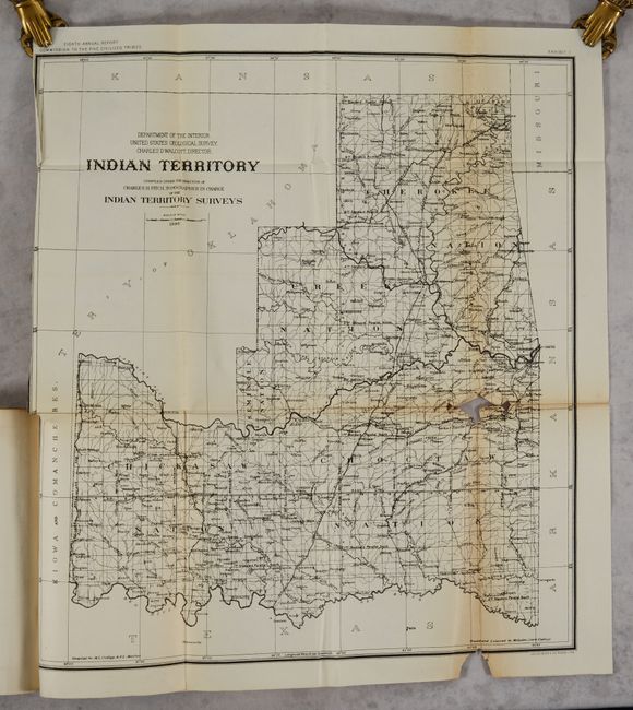
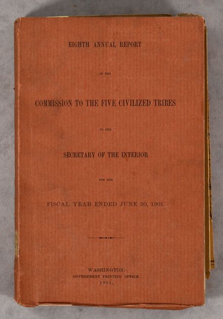
This is the eighth annual report of the Commission to the Five Civilized Tribes, with appendixes that detail treaties and legal decisions related to the tribal lands. The volume is well-illustrated with single-page, black & white photographs and folding maps. Of particular interest are the two maps of Indian Territory (A and D in the listing below) by Charles Fitch which match the configuration of the rare State of Sequoyah, which the Indian Nations attempted to create in 1905 in an effort to thwart the expansive tendencies of the United States. It is also similar to the rare 1896 Senate edition which was issued in printed color. The regions of the Chickasaw, Choctaw, Creek, Seminole, Cherokee, and several other Indian tribes are named. The Territory of Oklahoma hovers ominously in the northwest. Fitch was the topographer in charge of the Indian Territory Surveys. The full listing of maps in the volume include:
A. Indian Territory, dated 1898, black & white (18.0 x 20.0").
B. Map Showing Progress of Allotment in Creek Nation, dated 1901, printed color (24.7 x 26.4").
C. Map of Seminole Nation Showing Progress of Allotment, dated 1901, printed color (10.2 x 19.1").
D. Indian Territory - Progress of Sub-Division Survey, dated 1898, printed color (18.0 x 20.0").
E. Map of the Cherokee Nation Indian Territory Compiled from Official Records of the United States Geological Survey, dated 1900, printed color (25.8 x 35.0").
F. Creek & Seminole Nations Indian Territory..., dated 1899, printed color (24.7 x 26.5").
G. Map of Chickasaw Nation Indian Territory..., dated 1900, printed color (30.5 x 33.3").
H. Map of Choctaw Nation Indian Territory..., dated 1900, printed color (33.0 x 36.9").
I. [Diagram Showing Irregular Holdings as Surveyed by the Commission Prior to Preliminary Allotment], printed color (15.0 x 15.0").
J. [Diagram Showing Same Section as Adjusted by Commission], printed color (15.0 x 15.0").
219 pp. Soft rust-colored paper wrappers.
References:
Condition:
Most of the maps are in A condition, with minor toning along the folds and short binding tears. The exception is the black & white example of the Fitch map, which is in C+ condition, with toning along the folds, several long fold separations that have been archivally repaired on verso, and some loss at a fold junction. Text and plates are clean and bright. Wrappers are lightly soiled and the rear wrapper has detached.