Subject: Idaho
Period: 1891 (dated)
Publication:
Color: Printed Color
Size:
26.8 x 40 inches
68.1 x 101.6 cm
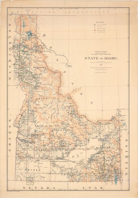
This large-scale map was produced just one year after statehood and is likely the first official map of the new state. It delineates 18 counties with numerous towns, settlements, and railroads identified. The map also shows the extent of surveying – more than half complete -- with a legend further identifying the Surveyor General’s Office in Boise City, other land offices, Indian and military reservations. Locates Fort Hall, Duck Valley, Nez Perces, and Coeur d’Alene Indian Reservations. Relief is shown color. Compiled and drawn by Robert Morton.
References:
Condition: B+
There is light offsetting with some minor edge tears and chips confined to the blank margins.