Subject: Palm Beach, Florida
Period: 1950 (circa)
Publication:
Color:
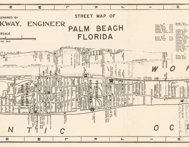
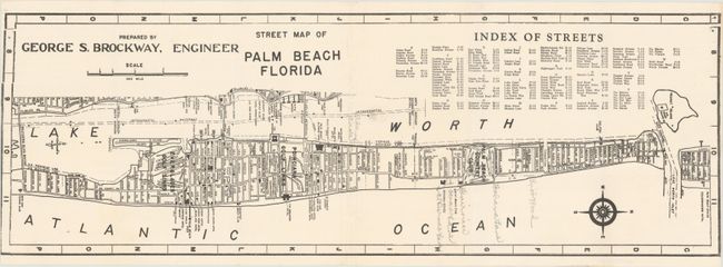
A. Street Map of Palm Beach Florida, by George S. Brockway, black & white (23.1 x 7.9"). This detailed street map extends from Peanut Island south to the Southern Boulevard Bridge, locating numerous points of interest including hotels, apartments, clubs, churches, golf courses and more. Includes a street index at top right with additional streets noted in pencil. North is oriented to the right. No examples of this edition located on OCLC. Condition: Issued folding on a bright sheet with a binder's cut into the left border. There are pencil notations in the image.
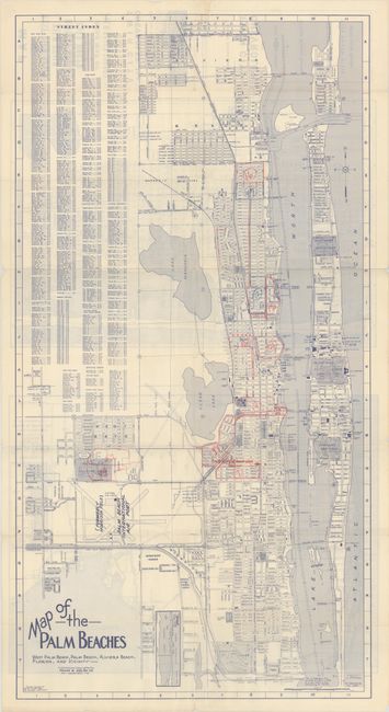
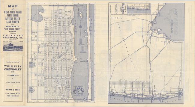
B. Map of West Palm Beach Palm Beach Riviera Beach Lake Worth - Road Map of Palm Beach County Florida, by Frank B. Dolph Co., printed color (16.0 x 30.8"). Another detailed street map extending further west to include Lake Mangonia, Clear Lake, and Palm Beach International Airport. There are numerous manuscript additions in red and blue pencil of numbers and routes, and there is an extensive street index at left. Compliments of Twin City Chevrolet, which is located on the map. The verso features large maps of Lake Worth and the Roads of Palm Beach County. Self-folding (4.3 x 8.7"). Only one example was located on OCLC (Yale). Condition: Issued folding with a few short splits at the fold junctions and pencil notations in the image.
References:
Condition: B+
See description above.