Subject: Connecticut
Period: 1937 (circa)
Publication:
Color: Printed Color
Size:
22 x 16.8 inches
55.9 x 42.7 cm
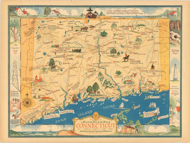
This historical map of the state was designed by Leon des Rosiers and published by the Historical Map Bureau in West Willington, Connecticut. Numerous illustrations fill the map showing landmarks, notable individuals, natural features, and historical notes. Modern details important to the tourist augment the map including roads, railroads, airports and beaches. Surrounding the map image are illustrations of important sites across the state including The Charter Oak, Harkness Memorial (Yale), and Groton Monument. Further decorated by an elaborate 16-point compass rose with fleur-de-lis and banner-style title cartouche.
References: Rumsey #8949.
Condition: B+
A colorful example with a 1.5" edge tear at top that has been closed on verso with archival tape. There are a few other short edge tears confined to the margins and light toning along the sheet edges.