Subject: Western United States
Period: 1865 (dated)
Publication:
Color: Hand Color
Size:
18.1 x 13.8 inches
46 x 35.1 cm
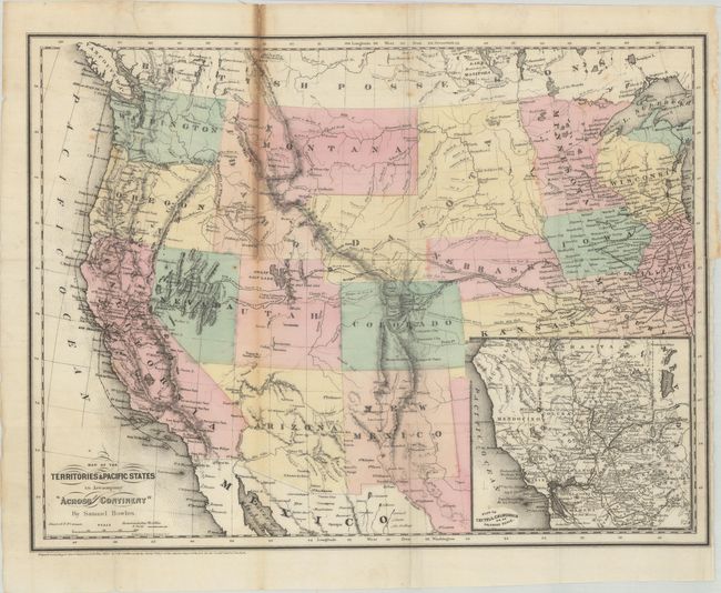
A handsome map of the western United States showing the routes of the Union Pacific and Central Pacific railroads, the Butterfield Express and Stage route, mail routes and the tracks of the Colfax expedition. The Spanish Trail and Emigrant Road are also featured on this very detailed map that was engraved by Goldthwait and printed by Colton on banknote paper. The large Dakota Territory includes today's Wyoming and Arizona is still in possession of the southern tip of Nevada. An inset titled Plan of Central California on an Enlarged Scale is at lower right.
References:
Condition: B+
Issued folding with a 3" binding tear at right and a 6" fold separation that have both been closed on verso with archival materials. There is toning along the same fold that is separated.