Subject: World
Period: 1782 (dated)
Publication: Atlas Portatif
Color: Hand Color
Size:
13.3 x 8.5 inches
33.8 x 21.6 cm
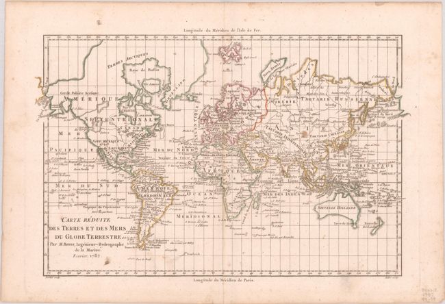
Handsome copper engraved world map on Mercator's projection. Greenland and the Arctic are attached to North America. Alaska is shown with a rudimentary shape. The most interesting features are the large, unnamed Sea of the West in the Pacific Northwest with its outlet named Canal du Roi George and a river connecting it to Hudson Bay. Above this is another large lake with a huge river flowing to the Pacific at Is. San Carlos. Australia is named Nouvelle Holland and is attached to Terre de Diemen. Numerous small islands are shown throughout the oceans. Engraved by Andre.
References: McGuirk #181.
Condition: B+
A crisp impression on a bright sheet with three small stains in Asia.