Subject: Central United States
Period: 1875 (published)
Publication:
Color: Black & White
Size:
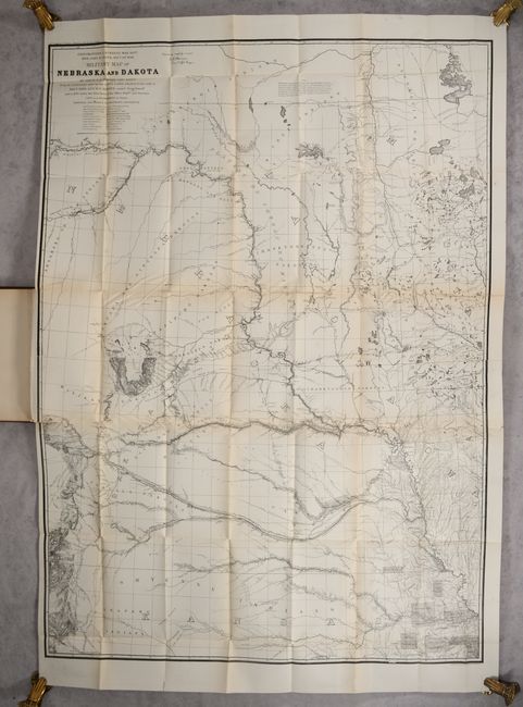
31.6 x 42.3 inches
80.3 x 107.4 cm
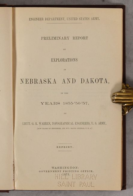
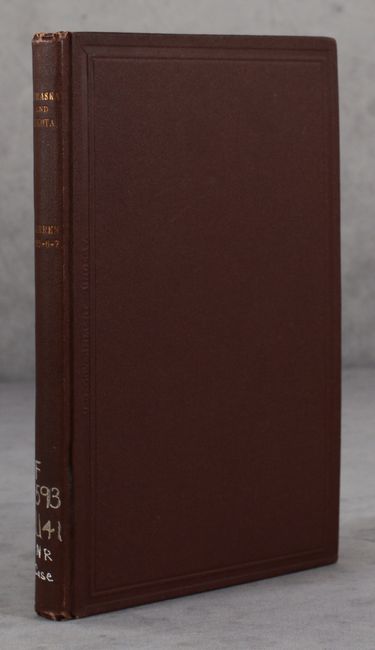
This exceptionally detailed map illustrates the topographical features of the northwestern Great Plains region extending from the Canadian border south to Pikes Peak, Colorado, and from the Colorado Front Range east to Leavenworth, Kansas. It is a compilation of numerous surveys and explorations in the region, including those of the Government Land Office, Pacific Railroad Surveys, Stansbury, Fremont, Nicollet and many others. Wheat notes that while the map was "made to show Lieutenant Warren's explorations, the many other explorers' routes, carefully shown, and particularly General Harney's route, give this map a position that is notable among all those of this period." First published in 1858, the map is also noteworthy for its early depiction of a "Gold Field" along the Colorado Front Range in the vicinity of Auroria, near the then-future home of Denver. Other details include Indian ranges, reservations, forts, proposed roads, land descriptions, and much more. Lithographed by Norris Peters. Bound in the back of the 125-page report (6.0 x 9.0"). Howes observes that this reissue was in response to the interest in the Black Hills gold discovery of 1874. Hardbound in maroon cloth with gilt title on spine.
This map served as the topographical base for F. V. Hayden's geological map of Nebraska and Dakota provided with his Final Report of the United States Geological Survey of Nebraska published in 1872.
References: Wheat (TMW) #1005; Howes #W-120.
Condition: B+
Issued on sturdy paper, the folding map is clean and bright with several repaired fold separations along a single horizontal fold. 2.75" and 1.5" binding tears at left have also been archivally repaired. Text is very good with a hint of toning. There is an old library stamp on verso of the map and a perforated library stamp on the title page. Covers have minor wear.