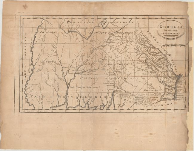
Subject: Southern United States
Period: 1795 (published)
Publication: Carey's American Atlas of Guthrie's Geography
Color: Black & White
Size:
15.7 x 9 inches
39.9 x 22.9 cm
This scarce and significant map covers from the Atlantic seaboard to the Mississippi River; present-day Georgia, Alabama and Mississippi. There is good topographical information particularly in the eastern section, where early counties in Georgia are named and their boundaries given. The interior is labeled Country of the Creek Nation of Indians with several other tribes located and the notation These Parts are little known. Several Creek and Cherokee villages are located and the trading paths to the interior are shown. This is the first state with no page number in the plate.
References: Wheat & Brun #611; Phillips (Maps) p. 296.
Condition: B
There is moderate toning and foxing, and dampstains along the right sheet edge. Most of the right margin has been replaced with portions of the neatline drawn in facsimile.