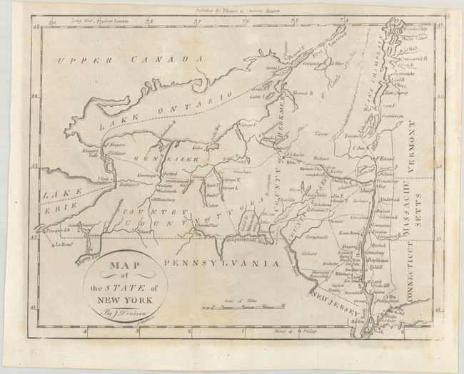
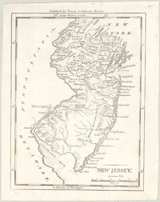
Subject: New York & New Jersey
Period: 1796 (circa)
Publication: The American Universal Geography
Color: Black & White
These early state maps from Morse's The American Universal Geography show topography, watershed, town names, and more. Meridians are from both London and Philadelphia. Published by Thomas & Andrews, Boston.
A. Map of the State of New York (9.7 x 7.4"). In the lower portion of the state there is an area marked Ceded to Massachusetts. Chautauqua Lake appears as Calaughaque L. Drawn by J. Denison, engraved by Amos Doolittle. Condition: Issued folding with a few faint spots and light toning. (B+)
B. New Jersey (5.6 x 7.4"). The distance scale is in "American Miles." The area extends from the tip of Long Island and Manhattan to the shoals in Delaware Bay. Engraved by Samuel Hill. Condition: A clean and bright example. (A)
References: McCorkle (18th C. Geography Books) #304-7 & 304-8; Wheat & Brun #368 & #417.
Condition:
See description above.