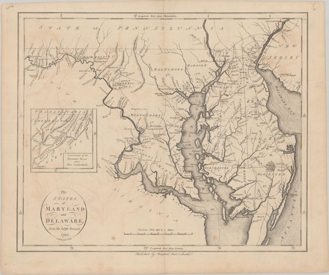
Subject: Maryland & Delaware
Period: 1795 (dated)
Publication:
Color: Black & White
Size:
17.1 x 14.2 inches
43.4 x 36.1 cm
This is the first state of this uncommon and early map of Maryland and Delaware with the "Wayland, Reid, & Smith" imprint beneath the bottom border. It was engraved by D. Martin for John Reid's rare American Atlas, which was also the atlas to accompany Winterbotham's An Historical, Geographical, Commercial, and Philosophical View of the United States of America. Derived from Samuel Lewis' 1794 map, this map extends as far north as Philadelphia and as far west as Fort Cumberland, with an inset that tracks the Potomac even farther west. Counties, towns and cities (including Washington and Baltimore), roads, and waterways are named, with some scattered topographical details. Portions of surrounding states are depicted but largely unengraved.
References: Phillips (Atlases) #1216-13; Wheat & Brun #517.
Condition: B+
There is light offsetting, a couple of minor stains, and an archivally repaired centerfold separation at bottom.